At the most recent North Ward Neighborhood meeting on September 5, the attendees compiled a list of notes and queries about historic elements of the neighborhood. What can you add? Which questions can you answer? Help us create a North Ward component for the town historical tours.

HISTORY NOTES
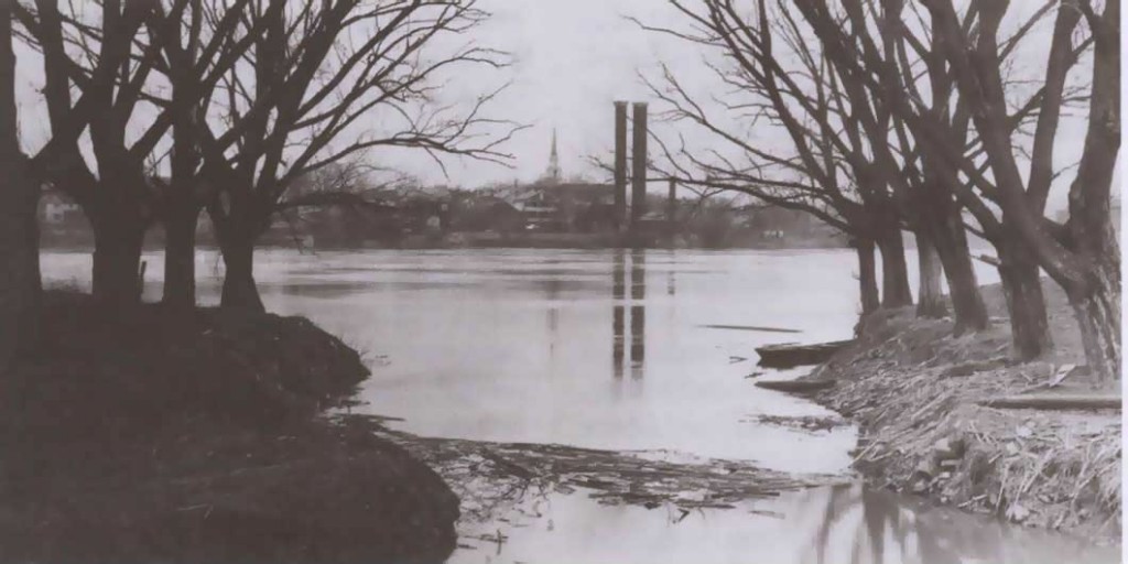
- The house at the corner of St Anthony and N Water St was the tollhouse for the old bridge originally, or at least one portion of it was – presumably the front. Where exactly was it located in relation to the RR bridge? There is a common misunderstanding that it would have been near the end of Market St, but that was not The Bridge in that erea – in fact the Rt 45 bridge did not exist at the time. Market St was not a through street.
- The railroad bridge was used for both rail and wagons and foot traffic. There were toll rates for all types of vehicles.
- The rr bridge was destroyed in a flood in what year?
- The round stone foundations at the southwest corner of Soldier’s Memorial Park were the bases of cylindrical water towers for the town. Were they fed by water pumped from the river or piped into town from higher elevations to the west?
- The “lion house” on St Anthony was built on a tract of land that was originally 54 acres. How did those boundaries overlay the current plat of the town?
- How many bakeries did the town, and the neighborhood, support? Known names include Grenobles, Aumullers, Keeley’s, Catherman’s… were there any more and where were they?
- There used to be a fire rehearsal tower on the far side of the community garden. Was it south of St Anthony? Bob Stackhouse (and Dave Arndt?) helped build it. The fire house training grounds were on what’s now the softball fields. Around what years was this?
- There was another movie theater in town, in the North Ward. The Roxy Theater was located behind Subway. Was it north of Cherry Alley?
- There was also a yellow church on 3rd St in the block that is now parking/Heritage/Cole’s.
- The Oldsmobile garage was “behind” the Roxy. Which direction? On the alley?
- Dave Arndt noted that there used to be film reels shown of everyday life in Lewisburg from the early 1900s. They had been shot by a Bucknell professor. He wonders if they might be in an archive at the university? Having followed up on this a bit, there does not appear to be an archive on campus, but it would be worth checking with the Library of Congress which preserves documents of that sort. Silver nitrate films of that vintage are incredibly fragile, and flammable.
- There was a dump at the end of N 3rd St, at Beck St. What could be recovered there or along any of the embankments at the edges of town? Might the person who did the rapid archaeological dig in Northumberland earlier this year be interested in these locations?
- It would be good to compile the list of things that existed previously on the Cole’s site, and their years of operation. Previously it was Weis Markets, a passenger rail station and a church. Anything else?
- The soccer fields in Kelly Township are documented to be laden with Native American artifacts, flint, etc, as recorded by PennDOT during construction of River Road. Would Wolfe Field be similar? Would that be a good dig site?
- Much of Wolfe Field is a capped dump, which would obliterate or overlay earlier layers. Is that also true of the lower portions by the entrance?
- It would be interesting to catalogue modifications to stock homes/typologies in town.
- The commercial district extended much further into the neighborhoods than they do now. Examples: there was a gunsmith’s shop across from the North Ward School; the Feese (sp?) grocery store on N Front?; a corner market, later Dor-Day’s, at 5 points in the ground level portion of the Stackhouse home (the lower door along St Anthony); Montgomery’s Bar, aka Bucket of Blood, where Temperance House is today.
- Was the Donald Heiter house at 5 points a gift from the borough?
- The Community Center building was originally a printer.
- Heritage House was originally proposed as a high rise (similar to the public housing in Sunbury) to be sited where the gazebo now stands in Hufnagle Park. It was one option for the neighborhood that was cleared after the 1972 flood. It only gradually became a park. When the borough fought the highrise siting, it was moved to another location. And gradually the design was transformed to the format we see today, which is considerably more responsive to the surrounding context.
- Street of Shops was a chair factory and later part of Pennsylvania House.
- The empty lot at 3rd and St John was a funeral home.
- When did flood acquisitions occur on N Water?
- Behind the greenhouses is an old ice house believed to be on the historic register.
- Roller Mills is historic. It was a feed mill. (Slightly outside the official neighborhood boundaries)
- One attendee remembers riding on the trolley that ran along St John St. There were trains on the tracks and also regular one-car trolley runs. The trolley operated for decades and was at various times powered by a diesel engine or by a battery. The car that ran the line is currently on display at the Railroad Museum in Strassburg. An example of the train schedule from the 1920s is incorporated into the interpretive signs for the rail trail. It shows the trolley running many times a day from Montandon to Lewisburg as well as making multiple daily longer runs to Vicksburg and Mifflinburg. The freight rail ran some 50 miles beyond Mifflinburg, through the tunnel at Poe Paddy (at the end of the Cherry Run primitive bike trail in the West End) and on toward Bellfonte.
- The railroad tracks were in place on St John St until 1988 at which point the tracks, with grassy swales on either side and the single lane of pavement were redesigned to include two lanes of traffic, parking, curbs, tree lawns and sidewalks.
- There are rumors that the underground railroad also operated in the north part of town. House at 3rd and St Anthony revealed unusual storage spots and access hatches during renovation. Opportunity to share stories, compare notes, trade lore?
- One attendee’s mother lived in one of the rowhouses at the east end of St Anthony St in the early 1900s. She reported that the municipal horses were stabled down the hill in what is now Wolfe Field.
- Dave Arndt noted that the Armory was on N 6th St “until it blew up.” Then they moved it further away.
- Was the house at the north end of Front St originally a firehouse or an electrical substation?
- When were the streets paved on the north side of town? Was 3rd St first?
- Harald Wagner has pictures of a small women’s educational institution originally on N Front St (confirm).
- The north side of town has more industrial history than the south.
- There were multiple saw mills and a boat yard for building canal boats near the mouth of Buffalo Creek. They are visible, along with some of their watery work space, aka log runs, in this 1868 map. They also appear on Sanborn (fire insurance) Maps as an inset item, rotated and shifted to some blank space on another plat which leads some to believe they were near the mouth of Limestone Run, but the map is clearly labeled with St Anthony St and N Water St. They built canal boats which operated both on the river in a limited capacity and in the canal that ran along the east bank, through Montandon (possibly where the freight rail line is now?).
- There are several walking tours of Lewisburg available. Ben Marsh, geography professor at Bucknell, has his online.
- The tour compiled by the Union County Historical Society identifies 3 properties in the North Ward for comment (out of 54 notes): the North Ward School, originally built in 1855; the adjacent Queen Anne structure, built in 1885; and a series of variation on a theme row houses in the first full block of N 3rd St.
Have you compared what your property looks like now to the historic birdseye view of the town (also on Ben Marsh's website)? Does it look the same or are there obvious differences?
What other items can you add to the list?

