The next Hidden Lewisburg Tour will be on the afternoon of Friday, February 7, at 4pm, as part of the Ice Festival. We'll start in the Borough Council Chamber in the Borough Building at 55 S 5th St. We can admire the historical photos that have now been mounted on the walls since the room was renovated. We'll meander a bit off Market and end by 5:30pm. Last year's Ice Festival tour was COLD! Dress for the weather, whatever it is!
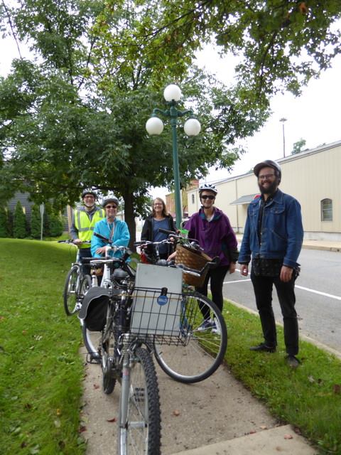
If you're not from here, Pennsylvania can really seem like an insider's game. It often seems like the only way to know about the best place to eat or hike or swim is to have always known about it. In an effort to counteract this phenomenon at least right here in the Borough, we launched a new program called Hidden Lewisburg Tours last year. The tours are intended to offer insights into lesser-known and often overlooked aspects of the community. Sometimes these things are overlooked because they are no longer present and, being unmarked, are simply forgotten. Sometimes they are just off the beaten path. Either way, it seems like there is more than enough to capture the fancy of people. On the first tour which was conducted by bike on a September morning a couple years ago, all the participants agreed that our slow roll (we covered just 3 miles in two hours!) was fun and informative -- even the two people who were born here!
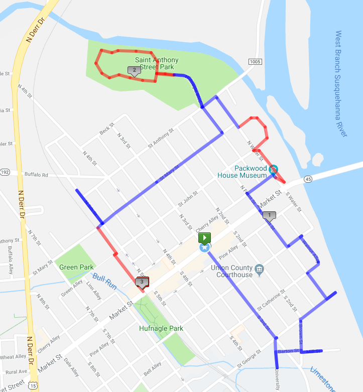 This is a rough outline of our path that time including a listing of what we looked at and discussed along the way. It does not include the actual content other than the headings, but this should give you a sense of the flavor of the tour. It does not visit the marquee sites like Bucknell, the County Courthouse, the Post Office, or the core of downtown. But that's the point! Check out the Union County Historical Society walking tour brochures for info about those more prominent locations. You'll also see that it has a characteristically spiky shape. There is not a smooth loop one can follow to visit the river's edge in town. In fact, every spot you can get to the water is notably disconnected from every other spot. You have to trace the path of the water at a remove and dart toward the riverbank intermittently. We were biking this time so it wasn't as emphatic as when we've done this as a walking tour, but there are no sidewalks on the river side of any of the roads. The sidewalks are all on the far side of the road. So to follow that infrastructure network, you have to leave the riverbank, cross the public space you're visiting, cross the curb, cross the street, cross another curb, and then reach the sidewalk. Certainly room for improvement there!
We have also done many walking tours as well as another biking tour since then covering different quadrants of downtown plus Market St. There is some overlap from tour to tour, but not much. The common thread is enthusiastic participants whatever the weather!
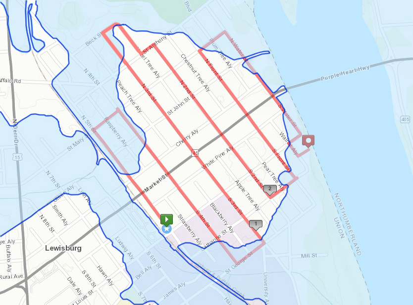
This was the route of another Bike Tour starting from the Borough Buildling and zig zagging across downtown examining the edges of the 100 year floodplain. We ended at Mariah's Garden.
LEWISBURG WATERFRONT SITE LIST
TOWN CENTER
- Federal Reserve Bank of Philadelphia Relocation Center
- Roxy Theater site
- Opera lot
- Fire Station lot
- Little Free Libraries
SOUTHERN REACH
- Sledding hill
- Poetry Path
- Mill race
- Pumping Station
- Terrace “Street”
LEWISBURG LANDING
- Boat Ramp
- Gas Company industrial history
- River Walk
- Park improvements
- Floodstage marks on street sign post
MARIAH’S GARDEN
- Flood elevated house
- Mariah’s Garden
- Slackwater Dam
- Water St
LOOP ACROSS MARKET
- Former sanatorium
- Better Homes and Gardens Model home
- Vacuum Store/Museum
- Mondragon Used Book Coop
- Brasserie Louis/Outdoor Terrace
NORTH WARD EAST
- Market Street Pedestrian Crossing Signs
- Masonic Lodge
- Old Library -- Himmelreich Building
- Implied pedestrian crossings
SOLDIERS MEMORIAL PARK
- Bridge abutment
- Water Tower foundations
- Tollhouse/ferry cable anchor
- River islands
- County boundary
ST JOHN ST
- RR on St John St
- RR Station/Weis/Cole’s
- Hidden businesses: Fisher's and Champion
- Former alley
STREET OF SHOPS
- Slaughterhouse site
- Community Garden
- Canal boat building
- Construction cofferdam at creek mouth
- Bridge with sidewalk on fishing side
WOLFE FIELD
- Cavalry site
- Lumber mill and storage
- Landfill
- Swimming hole
- Delta across creek at AYSO fields
- Relocated tollhouse
NORTH WARD NORTH
- Electrical substation turned into house
- Hidden commerce: Catherman’s Cakes and Candies
- Fire House/Antique Fire “Truck”
- Bowling Alley
- Community Center
- RR/former double deadends on 5th St
RAIL TRAIL IN TOWN
- Feed Mill
- Double track spurs to coal yard
- Four tracks crossing Market
- Covered Bridge
- Cannery site