
 The River Town Team Connectivity Project hosted two tours recently entitled “How Does the Chicken Cross This Road?” referring to Rt 15 in Lewisburg. Both tours were well attended attesting to the high level of interest in this question. Between the additional rail trail construction and all the new development at the Penn House Commons site, questions about how people can cross the highway safely on foot or by bike are very timely.
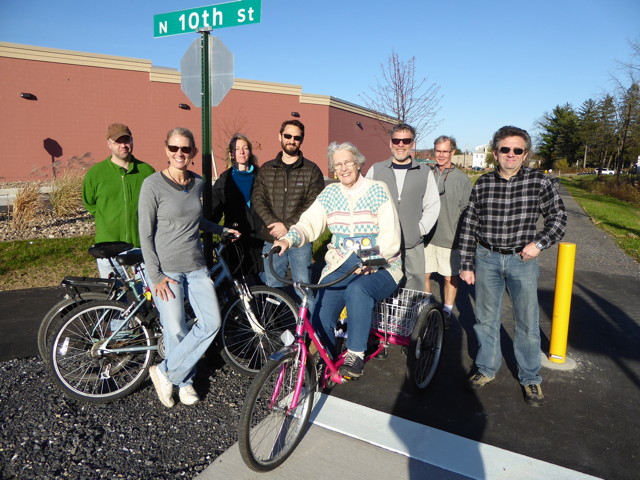
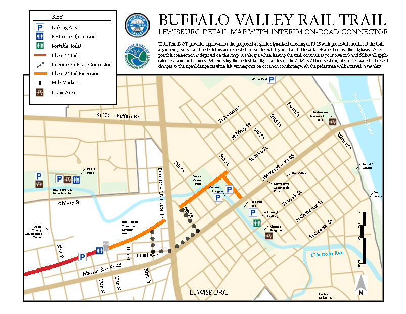
The tours started on the trail at the intersection with N 10th St, a part of the trail just completed this fall and unfamiliar as yet to many. We looped counterclockwise from there, down to the 15/45 intersection, back up past the end of the downtown segment of the trail, up to the St Mary St/15 intersection and back to our starting point. Along the way we reviewed past bike/ped advocacy efforts, the interim crossing options, and long-term planning for the future. This map from the Buffalo Valley Rail Trail provides some insight into how to use existing roads and sidewalks to cross the highway and includes one possible route. Currently all the options have their drawbacks and people will need to decide what works best for them right now.
At the same time, we encourage those who make this crossing regularly on foot or by bike to consider joining the River Town Team Connectivity Project. We will be working together for bike and pedestrian safety, advocacy and improvements in the community and the broader region. There will be a kickoff meeting on Friday, Dec 4, at 10am at the Borough Building. And the general topic will be addressed at evening River Town meetings (3rd Mondays at 7pm at the LNC Office, Borough Building 2nd Floor).
But enough about how us chickens currently cross the road. How should we cross the road in the future?
When the general public is confronted with the question of how best to cross, a desire for a bridge or tunnel is a common reaction. However, interestingly enough, when consultants, including transportation engineers for the County’s Route 15 Corridor Study did their project (2010 to 2012), they identified the trail crossing as a very high priority and recommended that it be accomplished with a signalized at-grade crossing. They worked with the existing and projected traffic counts and speeds for the road and determined that to be the best solution rather than a tunnel or bridge.
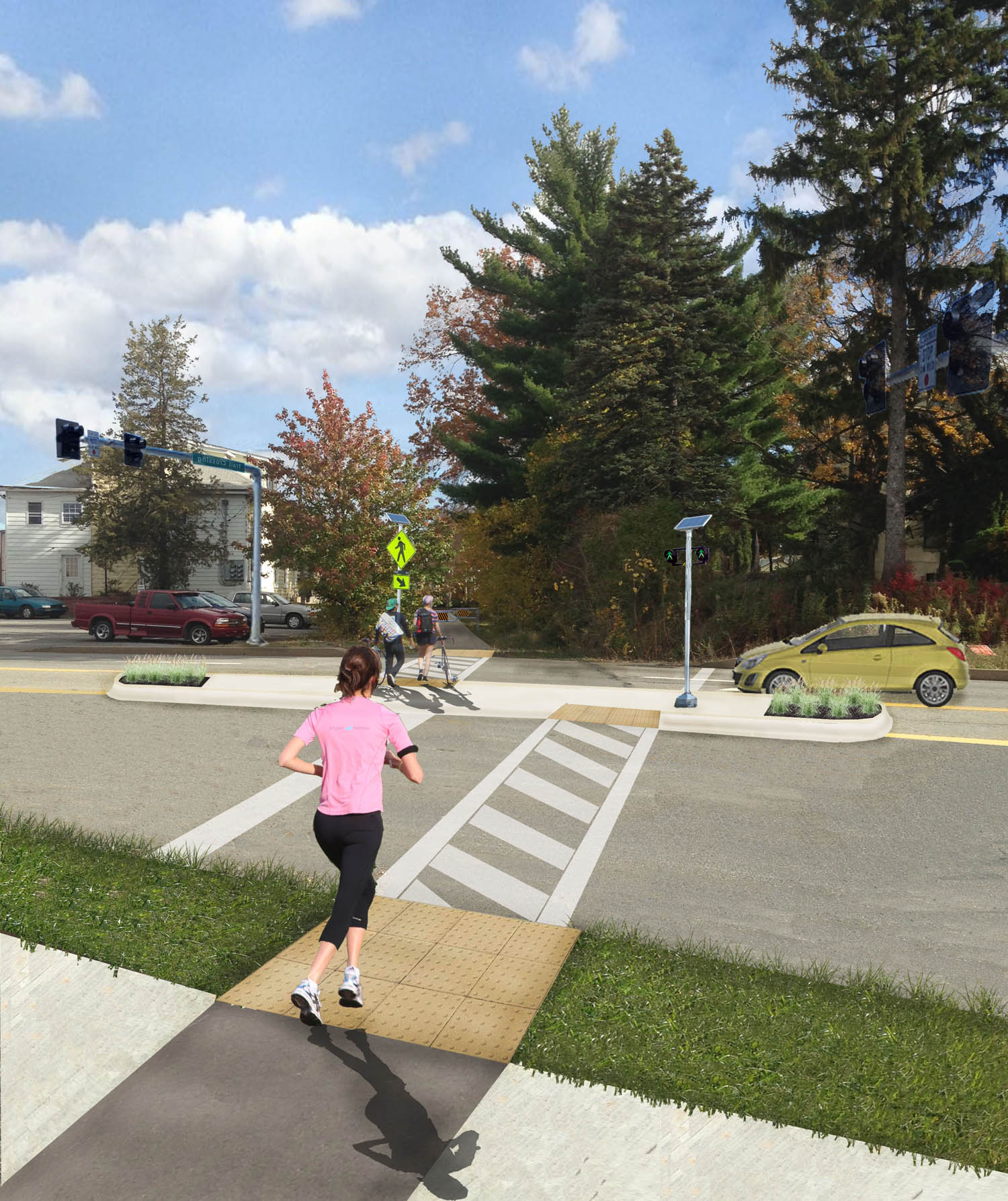
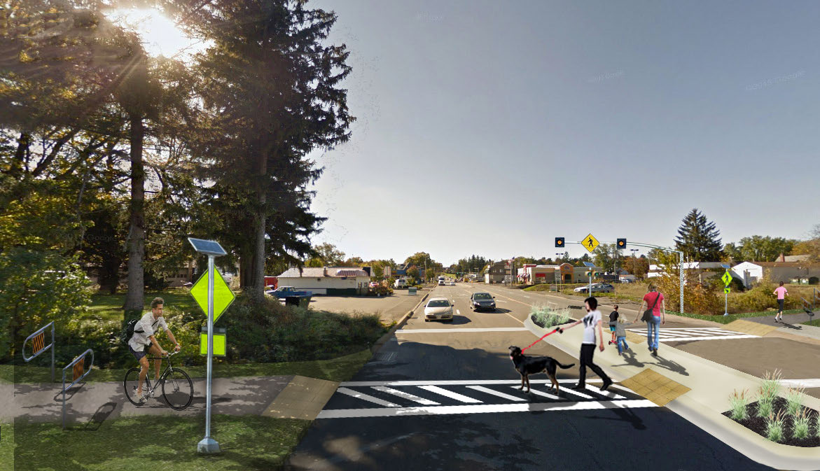
There was also a follow-on study completed by Larson Design Group and BU Engineering students completing their Senior Design Projects (available for download: November 2013 Final Report (14M)). It had three parts, looking at the river bridge rehab, trail design options between 8th St and the river, and the signalized at-grade crossing of Rt 15. Here’s one figure from the section of that report on the Rt 15 crossing.
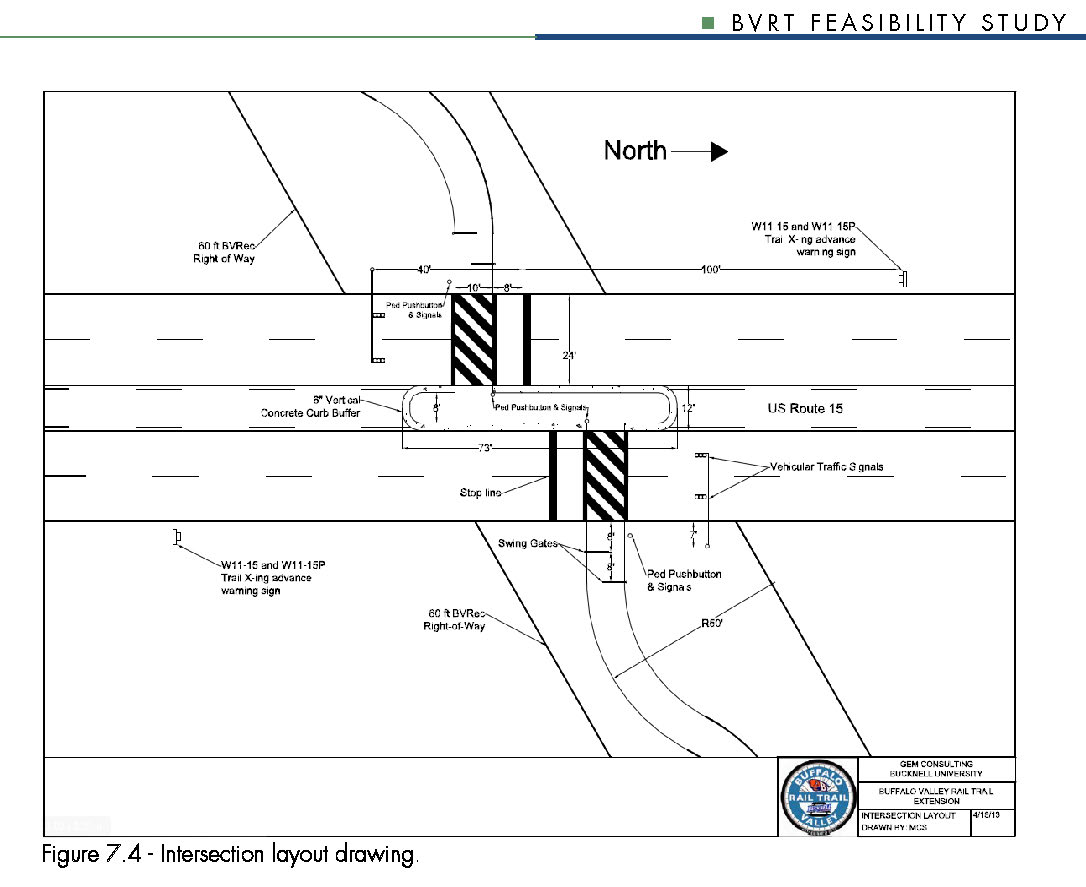
The at-grade signalized crossing, with a protected median island limits the impact on traffic flow by making the stop interval only 17 seconds as people cross two lanes of traffic either to or from a refuge island in the center lane. Doing this at the mid-block location also cuts down the complicated and problematic vehicular turning movements at the intersections, where there are 16 possible maneuvers for the vehicles in the zone where the pedestrian is crossing to 2, both coming from the same direction.
On the one hand, PennDOT at a statewide level has both the Complete Streets and the Context Sensitive Design programs each of which should lend themselves to creating a more humane setting at street-level throughout the community, including along Rt 15. On the other hand, PennDOT District 3-0 is staffed by transportation engineers who adhere to the policy of discouraging bike and ped crossings of state roads as if the district were entirely rural. If we were to create a bridge or a tunnel, PennDOT policy would be that all bikes and peds use that, throughout the community, so that even someone wanting to cross at 192, would be directed south 3 blocks and then back north 3 blocks. In some places, where a road is an impassable wall, that may make sense (for example Rt 54 in Danville or even Rt 15 north of William Penn Dr). But the reality is that crossing Rt 15 in the vicinity of the rail trail is actually relatively routine and is currently made less safe by the provisions in place. The fact that people cross successfully and illegally midway between the existing signals all along the strip points to the feasibility of building it as a safe and legal option.
It may seem counterintuitive, but it’s really a matter of looking at the specifics of this location and not coming in with a preconceived notion about what’s needed.
Sometimes it seems like engineers come in with one size fits all solutions, but the firms that have weighed in on this crossing have been far more thoughtful and responsive. Dan Burden of Walkable and Livable Communities was here for a presentation and walkability audits in May of 2009 and both the County Comp Plan and the Route 15 Corridor Study were done by Wallace Roberts Todd. The schematic plan is from a project done by Larson Design in collaboration with Professor Michelle Beiler and a senior engineering design student at Bucknell. So, on the one hand, we have PennDOT engineers saying no to any crossing, recommending instead everyone just drive to or from the trailhead (and wondering who would want to walk anywhere else). But on the other, we have considered input from engineers who have recommended the at-grade signalized crossing as the best solution, even in the context of the Safe Routes to School Program and similar 8-80 programs (for all ages).
There had also been some earlier cost assessments for tunnel and bridge, though at the time, the scope was simply to cost them out, not to ask whether or not they were called for. The rough figures for either one were $2M. And those numbers are from around 2008/9. The tunnel is complicated by the proximity to the creek (and low elevation, which is not simply a logistical matter requiring pumps, but also means that there’s little leeway to maneuver and there’s a major sewer line exactly at the elevation the tunnel would be expected to occupy). The bridge is also complicated because Route 15 is part of the National Defense Highway Network and requires more than the usual 14’ of clearance in case they need to transport missiles along it (!!!). That would translate into an additional 100’ of ramp on either side of the roadway.
But again, independent of cost, the engineers who assessed the road character, speeds and traffic counts, didn’t recommend either – not because they are hostile to pedestrians, but because they are recommending a comprehensive walkable future for Lewisburg.
 When we think about having a truly walkable community, it’s important to note that crossing Fairground Rd, either at the Rail Trail or at St Mary St is actually more daunting in some ways than crossing Rt 15 (at least before they changed the lights), and getting from there to the library is only marginally better (crossing and/or going along Reitz Blvd). In order to contend with these issues, it’s going to be necessary to transform our preconceptions about these roads as well as the landscape itself.
