
We prompted you recently to consider incorporating riding your bike into your daily routine. Making bike riding an option by thinking through the logistics is one way to reduce your dependence on automobile travel. Not everyone lives in a spot that is bikeable, but even those who live too far from work to bike there might consider keeping a bike at work and using it for small trips and errands during the day.
This post invites you to think more about your route(s).
While you may assume you know how to get to your destination perfectly well already, you may want to consider whether your knowledge is specific to your usual mode of travel. In other words, is it really a matter of knowing how to get there by car? Your bike route could be quite different. First of all, you will want to prioritize roads that carry less traffic, offer good bike accommodation, and have the best crossing options. For example, if I were to drive my car to my son’s school, I would drive down my street to the main road through town, take that route for about a mile, turn off near the school, and head to the parking lot. When I ride my bike, however, I am only on the main road for a block and a half, on sidewalk, and I approach the school from the opposite side, away from all the vehicular traffic.
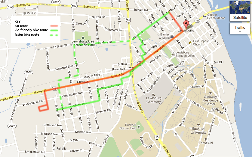
My bike route involves setting out on smaller roads and even alleys to get over to the best spot to cross the main road in a crosswalk. That gets me to the sidewalk , which I take over to the intersection with the local highway. There, it’s a matter of pressing a button and waiting for the walk signal so I can safely get across. Next I head into the nearby neighborhood and choose my path based more on the relative steepness of the streets than anything else. Once at the school, it makes great sense to come onto the grounds along a pedestrian access way, in a totally different area from the parent drop-off queue and the line of idling buses.
Though I have biked in this community for quite a few years, I had never had much occasion to go in this direction in the past, so the route was not immediately obvious to me. To prepare, I took several exploratory bike rides, just seeing where the least steep streets were, which was the best side of the major intersection to approach, and how best to access the school itself. This involved a bit of poking around and riding in circles, but ended up being very useful reconnaissance. Once I had the route down, I rode it to figure out how long it would take. In this case, I rode alone at my own pace and also practiced riding with my son. As a final step I walked the whole route in order to see how long that would take, in the event of a flat tire or other mechanical problem.
Out of curiosity I checked the route out on MapMyRun.com (a very useful resource for this sort of thing) just to see how long it was. 1.3 miles one way.
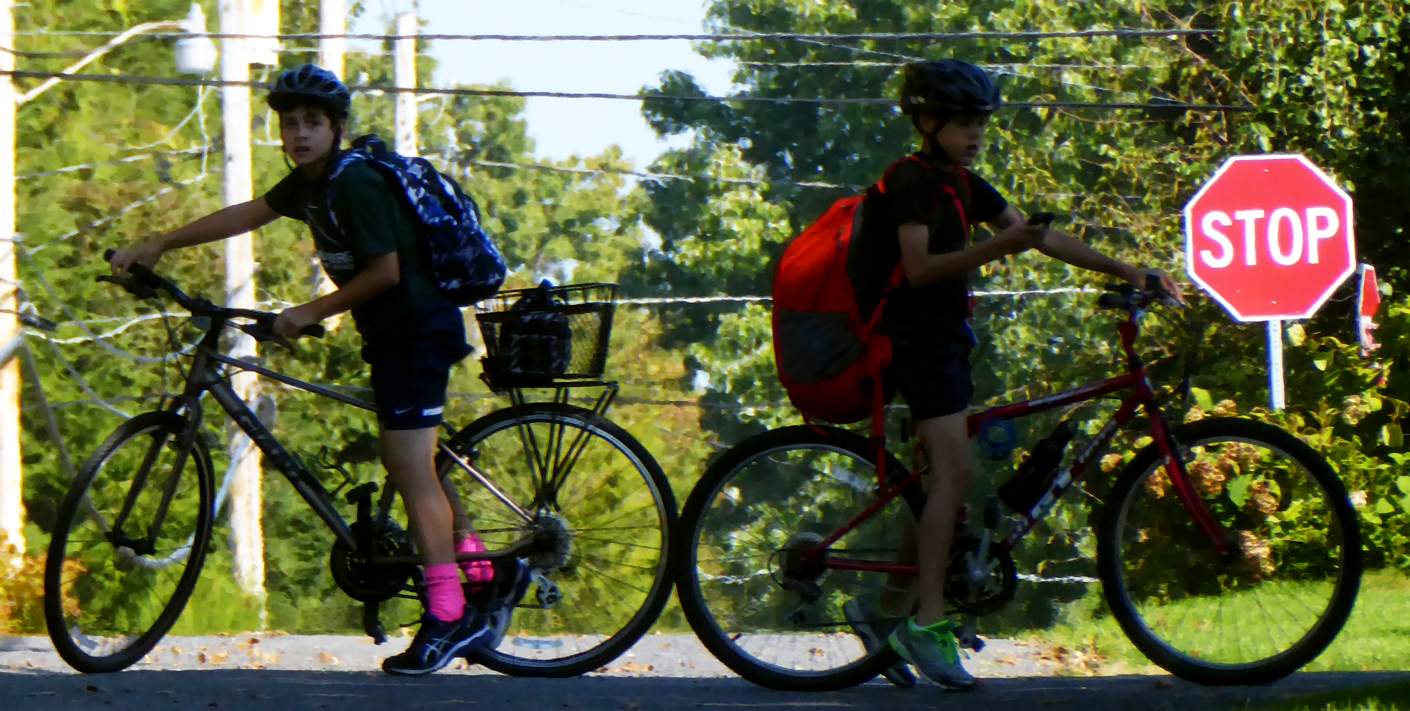 I developed this route for me and my son to ride together, but I also wanted him to be able to ride part of the way alone. We would meet and cross the busy highway together. On the days when I would go to the school on our tandem to pick him up (if it’s raining or too cold to ride in the morning ), I would take another route altogether, which would allow me to avoid the hill in the residential neighborhood. For that route, I take a straight shot, on a minor street with lots of stop signs, but also a stoplight for crossing the highway. This route allows me to cut over to our recently constructed rail trail for a few blocks, cross another main road just outside the school zone, and get to the usual side entrance to the school grounds.
This route represents a departure from what might at first seem to be the most obvious route, but a little bit of exploration and consideration has yielded a good alternative. I used similar transportation and navigation strategies in many of the other places I have lived.
When I used to commute through downtown Baltimore, I had routes that varied depending on the time of day. For example, I used to ride around the Inner Harbor along the waterfront in the early morning, when it wasn’t crowded with tourists. In the afternoon, I would shoot up the main commuter route, which happened to afford slightly better clearance between traffic and parked cars. The dynamic there was also different because of the changes in elevation. I lived upstream along the Jones Falls and rode down to an office right on the water, so the ride in was cool and not too strenuous, but the ride home was quite a workout.
Biking regularly into Cambridge or Boston also yields an intimate knowledge of cartway widths, side streets, and parks you can cut through. Even Miami affords the thoughtful cyclist a wealth of routes that avoid the primary auto thoroughfares. Seek them out. Know your options. There are many beautiful, and functional rides to be had out there.
How would your mental maps of the community shift if you looked at them as a cyclist?
